


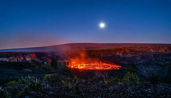

Start with the big five. Walk to the caldera overlooks on Crater Rim Drive. Hike the Kīlauea Iki Trail across a lava lake that hardened in 1959. Walk through Nāhuku, the Thurston Lava Tube. Feel the heat at the steam vents. Then drive Chain of Craters Road down to the Puʻuloa Petroglyphs. When Kīlauea is erupting, stay for the glow after dark.
[ASK JENNIFER: Share one real moment from a guest's first hour in the park, in 2 or 3 sentences. For example, a first look into Kaluapele, the Kīlauea caldera, or a first step onto the Kīlauea Iki crater floor.]
Here's what most lists miss. The park changes faster than they get updated. The Jaggar Museum was torn down in 2024. The Hōlei Sea Arch fell into the ocean in September 2026. And summit trails can close with little warning after a run of earthquakes.
I'm Jennifer Bell, founder and lead guide of Volcanoes Hiking Guides. Our guides lead hikes here every week under the park's Commercial Use Authorization. I'm also a Wilderness First Responder. So this list of things to do in Volcano National Park comes from the trail, not one vacation.
One more surprise. Mauna Loa shares the park with Kīlauea, so the land runs from sea level to 13,681 feet. You can hike through the rainforest in the morning and stand in the Kaʻū Desert after lunch.
What are the top 5 things to do in Volcano National Park?
Five stops show you what this park is about. You get a living caldera, an old lava lake, a lava tube, steam vents and ancient rock art. Here they are, with the time each one takes and why it's worth it.
# | Thing to do | Where | Time needed | Effort | Why go |
1 | Crater Rim Drive overlooks (Uēkahuna, Kīlauea Overlook) | Kīlauea summit, about 2.5 to 2.8 mi past the entrance | 45 min to 2 hours | Easy. Short paved path at Kīlauea Overlook | Look straight into Kaluapele, the Kīlauea caldera, and Halemaʻumaʻu crater |
2 | Kīlauea Iki Trail | Kīlauea Iki Overlook, Crater Rim Drive East | 2 to 3 hours (3.3 mi loop) | Moderate to challenging. About 400 ft down and back up | Walk across a crater floor that was a lava lake in 1959 |
3 | Nāhuku (Thurston Lava Tube) | Across the road from Kīlauea Iki Overlook | 30 to 60 min | Easy, with some stairs | Walk through a lit lava tube about 500 years old, wrapped in rainforest |
4 | Chain of Craters Road and Puʻuloa Petroglyphs | From the summit down to the coast | 2 to 6 hours with stops | Easy drive. Puʻuloa is 1.4 mi round trip with no shade | Pit craters, old lava flows, sea cliffs and about 23,000 petroglyphs |
5 | Steam vents (Kūkamāhuākea) and Wahinekapu (Steaming Bluff) | Crater Rim Drive West | 15 to 30 min | Easy. 0.1 mi gravel path, wheelchair friendly | Feel volcanic steam rise out of the ground at the caldera's edge |
Why these five?
These are the five stops we point first-time visitors to. Together they tell Kīlauea's whole story in one day. Each one shows a different side of a living volcano. They also suit almost anyone. Three of the five need no real hike at all.
If you only have time for one
Make it Kīlauea Iki. When we ask guests what stuck with them, they name the old lava lake and the lava tube next door. Start early. The parking lot fills fast, and the crater floor has no shade.
Short on time? A guided morning can cover two or three of these, with someone who explains what you're looking at. Browse our small-group volcano hikes.
How is Hawaiʻi Volcanoes National Park laid out?
The park has five main areas. Most visitors spend their day at the Kīlauea summit and on Chain of Craters Road. Mauna Loa Road, the Kaʻū Desert and the Kahuku Unit sit further out, and they're much quieter.
Area | What's there | Getting there |
Kīlauea summit (Crater Rim Drive) | Caldera overlooks, Kīlauea Iki, Nāhuku, steam vents, Devastation Trail, Welcome Center, Volcano House | Starts at the main entrance on Highway 11. Runs about 5.6 mi from Uēkahuna to the Devastation Trailhead |
Chain of Craters Road | Pit craters, Mauna Ulu, Puʻuloa Petroglyphs, sea cliffs at the road's end | Starts near the Devastation Trailhead. About 18.7 mi one way, 30 min without stops |
Mauna Loa Road | Tree Molds, Kīpukapuaulu forest, the road toward Mauna Loa Lookout | Turns off Highway 11 a short drive west of the main entrance. Narrow, single lane, many curves |
Kaʻū Desert and Hilina Pali Road | Footprints, Maunaiki, desert lava fields, Hilina Pali Overlook | Hilina Pali Road leaves Chain of Craters Road. 9 mi, single lane, no services |
Kahuku Unit | Ranch history and quiet trails over old lava flows | Highway 11 near mile marker 70.5, about 40 mi southwest of the main entrance. Roughly an hour's drive |
Driving both main roads with no stops takes about 2 hours round trip. Plan on much longer once you start pulling over.
Crater Rim Drive is now two roads
Crater Rim Drive no longer circles the caldera. Old sections are closed to cars. Today it runs out from the entrance in two directions.
Crater Rim Drive West: The Welcome Center, Kīlauea Overlook, the steam vents and Uēkahuna. These lots usually have more open spaces.
Crater Rim Drive East: Kīlauea Iki, Nāhuku, Devastation Trail and the start of Chain of Craters Road.
Our tip is to finish one side before you start the other. That way you're not doubling back past the entrance all day.
Wet side, dry side
The summit sits around 4,000 feet, right on a weather line. East of the caldera is dense rainforest. West and south of it is the dry Kaʻū Desert. The scenery and weather can change within a few minutes' drive.

What are the best things to do at the Kīlauea summit?
The Kīlauea summit lets you look into an active caldera, cross a lava lake and enter a lava tube. Nine of our 20 picks sit within a few miles of the entrance, along Crater Rim Drive. If you only have one day, spend most of it here.
1. Start at the Welcome Center and join a free ranger program
Where: Kīlauea Military Camp, 1.2 mi past the entrance station
Time: 20 to 30 min, longer with a ranger walk
Effort: Easy, wheelchair accessible
Good for: Everyone, as a first stop
The Welcome Center is where you find out what the park looks like today. It's the temporary home of the park's visitor desk while the Kīlauea Visitor Center is renovated.
Get today's picture: Rangers post the eruption status, trail closures, air quality and the day's programs.
Join a free ranger program: Talks and walks run nearly every day. "Life on the Edge" at Uēkahuna is a favorite for first-timers.
Pick up the essentials: A park map, a Junior Ranger booklet for the kids and a free wheelchair loan. The park store sells guidebooks too.
Give back: Stewardship at the Summit volunteers spend a morning pulling invasive plants from the rainforest.
Guide tip: Tell the ranger how much time you have and how far you like to walk. You'll leave with a plan built around today's conditions.

2. Drive Crater Rim Drive and stop at the caldera overlooks
Where: Crater Rim Drive West, from the entrance to Uēkahuna
Time: 45 min to 2 hours with stops
Effort: Easy, short paved paths
Best time: Morning for clear views, dusk when lava is glowing
Good for: Everyone, including non-hikers
Status: Open
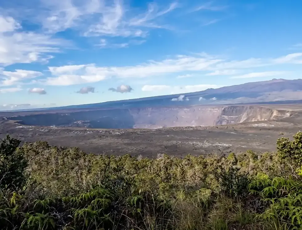
Crater Rim Drive runs along the edge of Kaluapele, the Kīlauea caldera. This giant bowl, about 3 miles wide, formed in the late 1400s when the summit collapsed inward. Inside it sits Halemaʻumaʻu crater, the "house of the ʻāmaʻu fern" and, in Hawaiian tradition, the home of Pele. A lava lake churned here for most of 1865 to 1924, and again after 2008.
Then came 2018. The summit sank on average every 28 hours, and Halemaʻumaʻu went from about 280 to 1,600 feet deep. What you see today is a brand-new landscape.
Uēkahuna: At the end of Crater Rim Drive West, with the biggest lot and rangers often on site. It's a wahi pana, a legendary place, and the Jaggar Museum and old volcano observatory stood here until 2024. Look for giant cracks in the crater floor and the faded centerline of a fallen road. On clear days, Mauna Loa rises behind it.
Kīlauea Overlook (Kapalikapuokamohoaliʻi): A 0.1-mile paved walk, or 0.4 mile along the rim from Uēkahuna. The cliff is sacred to Kamohoaliʻi, Pele's elder brother. One story tells of a chief who found refuge with Pele here. He lives on as the koaʻe kea, the white tropicbird often seen gliding over the crater.
Wahinekapu (Steaming Bluff): The first overlook from the entrance, where steam pours off the caldera wall. More in item 6.
These are living sacred places, not just viewpoints. If you see someone chanting or leaving an offering, give them space.
Guide tip: Start at Uēkahuna and work your way back toward the entrance. The free NPS App has a self-guided audio tour of the drive, so download it before you lose signal. Paid apps like Shaka Guide and GuideAlong add GPS-triggered stories.

3. Watch the eruption glow, and the stars, after dark
Where: Open overlooks on Crater Rim Drive West
Time: 1 to 2 hours
Effort: Easy
Best time: From 30 min before sunset
Good for: Photographers, couples, night owls
Status: Glow only during an eruption episode
In daylight, an eruption can look like little more than a plume of steam. After dark, Halemaʻumaʻu glows orange, and the color deepens minute by minute. Kīlauea erupts in episodes, so check the status on the day you plan to go.
Where to watch: The eruption area itself is closed. Use open rim overlooks like Uēkahuna, Kīlauea Overlook and Kūpinaʻi Pali.
When to arrive: About 30 minutes before sunset, then stay an hour as the light fades. Crowds thin out later in the evening.
What to bring: A headlamp, warm layers and a rain jacket. The summit turns cold and damp at night.
No glow? Stay for the stars. The park is open 24 hours and sits far from city lights. Clear, moonless nights are best, though vog can hide the sky. We don't run night hikes. A morning hike with us plus a dusk visit on your own makes a full day.

4. Hike the Kīlauea Iki Trail across a 1959 lava lake
Where: Kīlauea Iki Overlook, Crater Rim Drive East
Time: 2 to 3 hours (3.3 mi loop)
Effort: Moderate to challenging, about 400 ft down and back up
Best time: Early morning
Good for: Active hikers and kids who like to hike
Status: Open
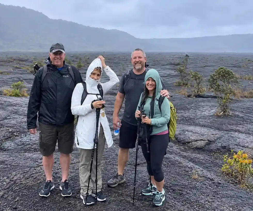
Kīlauea Iki means "little Kīlauea." It's a crater beside the main caldera, and its floor was liquid rock in 1959. You start in a dripping rainforest of ʻōhiʻa trees and hāpuʻu tree ferns. Then the trees stop, and you step out onto it.
That eruption came in 17 bursts over five weeks. Its fountains hit 1,900 feet, a record for Hawaiʻi. Lava filled the crater into a lake more than 400 feet deep, at about 2,200°F. It took until the mid-1990s to fully harden.
On the floor: Rock cairns (ahu) lead you past steaming cracks, with small plants pushing up through the lava. After rain, the steam is easier to see.
The vent: The 1959 fountains burst from the base of Puʻupuaʻi, the cinder cone towering over the floor.
Look up: A ledge on the crater wall, nicknamed the "bathtub ring," shows how high the lava lake once rose.
The climb out: It's the hardest part, so save some energy.
Hike counterclockwise, turning right from the overlook. Download the park's free trail guide, which explains the numbered posts along the way. Short on time? Walk down to the crater floor and come back the same way. There's no shade on the floor, so bring water, sun protection and a rain layer.
Parking at the overlook is tight, though the lot has restrooms. You can also start from the Puʻupuaʻi lot. Or walk in from the Kīlauea Visitor Center area, a 5.3-mile round trip. Not up for the hike? The view from the Kīlauea Iki and Puʻupuaʻi overlooks is just as wild.
Hike it with a guide: Our guided Kīlauea Iki hike runs daily at 8 or 10 am. It covers about 7 km and includes Nāhuku. When the group is ready, we cross the crater floor while your guide explains what's underfoot.

5. Walk through Nāhuku (Thurston Lava Tube)
Where: Across the road from Kīlauea Iki Overlook, Crater Rim Drive East
Time: 30 to 60 min (1.5 mi round trip from the overlook)
Effort: Moderate, with stairs
Best time: Early morning or late afternoon
Good for: Families
Status: Open, with a new entrance bridge since August 2026
A lava tube forms when a river of lava crusts over on top but keeps flowing underneath. When the eruption stops, the lava drains out and leaves a hollow tunnel. Nāhuku formed this way about 500 years ago, and it's the easiest lava tube in the park to explore. A short path drops through tree ferns and birdsong to its mouth. Then the forest goes quiet, and you're walking inside the volcano.
The name: Nāhuku means "the protuberances," likely the lava drips that once hung from the ceiling.
Where they went: After Lorrin Thurston publicized the tube in the early 1900s, visitors broke the drips off as souvenirs. Don't touch the walls or tree roots.
Lights: On from 8 am to 8 pm. The tube stays open later, so bring a real flashlight if you go after dark.
Underfoot: Expect low ceilings, puddles, uneven ground and loose rock.
The tiny lot fills by mid-morning. Go early or late, or walk over from Kīlauea Iki Overlook. Keep an ear out for native birds in the rainforest along the way. Our 4.5-hour and 6-hour hikes both include Nāhuku.

6. Feel the heat at the steam vents, Wahinekapu and Haʻakulamanu (Sulphur Banks)
Where: Kūkamāhuākea (Steam Vents) lot, Crater Rim Drive West
Time: 15 min to 1 hour (0.1 mi to Wahinekapu, 1.2 mi round trip to the Sulphur Banks)
Effort: Easy, mostly wheelchair friendly
Best time: Cool mornings
Good for: Everyone, including limited mobility
Status: The Sulphur Banks bridge has been closed since the September 2026 storms
Hold your hands over the vents beside the parking lot and you'll feel the volcano breathing. Rainwater seeps underground, hits rock heated by the magma below and rises back up as steam. A whole line of vents runs from the lot to the caldera rim. On cool, damp mornings the steam thickens, and when the sun breaks through, look for rainbows.
Wahinekapu (Steaming Bluff): Its name means "sacred woman." A 0.1-mile gravel path, fine for wheelchairs, leads to steam pouring over the caldera edge.
Haʻakulamanu (Sulphur Banks): Think of a small Yellowstone. Volcanic gas seeps through the ground here, crusting the rocks yellow, green and red. Acid in the gas slowly breaks the lava down into clay. The rotten-egg smell is hydrogen sulfide, and on a still morning it carries a long way.
Health warning: The gases include sulfur dioxide, hydrogen sulfide and carbon dioxide. Skip the Sulphur Banks if you have heart or breathing problems like asthma. The same goes if you're pregnant or with infants or young children.
Hike it with a guide: Our 3-hour Nature and Steam Vent Hike runs daily at 8 am, 12 pm and 3 pm. It's 3 to 4 miles with about 150 ft of climbing. You pass Steaming Bluff, the crater rim and Waldron Ledge. The 8 am start usually gets the clearest crater views, because the weather often shifts later in the day.

7. Walk the Devastation Trail and see Puʻupuaʻi
Where: Devastation Trailhead or Puʻupuaʻi Overlook, Crater Rim Drive East
Time: About 1 hour (1 mi round trip, paved)
Effort: Easy, wheelchair and stroller accessible, with some steep grades
Good for: Families, limited mobility
Status: Open
In 1959, falling cinder from the Kīlauea Iki fountains buried this forest in a matter of days. The same fallout built Puʻupuaʻi, "gushing hill," the cinder cone beside the trail. Walk the paved path and you'll see two worlds side by side. One edge is bare black cinder. The other is rainforest, with ʻōhiʻa and ferns slowly reclaiming the ground.
Stay on the trail and don't climb the cone. Parking is tight during eruptions.

8. Walk the Crater Rim Trail to Kūpinaʻi Pali (Waldron Ledge)
Where: Across from the Kīlauea Visitor Center, left of Volcano House
Time: 45 min to 1 hour (about 1 mi round trip)
Effort: Easy, mostly paved, wheelchair and stroller friendly
Good for: Families, seniors, strollers
Status: Open
The Crater Rim Trail once circled the whole caldera. Since 2018, it runs only in sections, mostly along the green, rainy east side. This stretch to Kūpinaʻi Pali is the easiest of them. It also has one of the widest views at the summit.
It's also a road after an earthquake. Until November 16, 1983, this was part of Crater Rim Drive. Then a magnitude 6.7 quake broke it apart. Locals still call it the Earthquake Trail, and painted road lines still show on the cracked, tilted pavement. The walk ends at a wide, level overlook of Kaluapele and Halemaʻumaʻu. It's farther from the vent than other overlooks, so it's often quieter on glow nights. Skip the first small overlook with a stroller, because its path is steep.
Walk it with your family: Our Keiki to Kūpuna family walk runs Friday to Sunday at 9 and 11 am. It's 1.5 hours on the Crater Rim Trail, with steam vents, crater views and a kids' scavenger hunt. With about 30 feet of elevation change, strollers and wheelchairs are welcome.

9. Hike Uēaloha (Byron Ledge) and the longer summit trails
Where: Devastation Trailhead, or near Volcano House
Time: 1.1 mi one way from Devastation to the Kīlauea Iki junction
Effort: Moderate
Good for: Hikers who want a longer loop
Status: Part of Byron Ledge and all of Halemaʻumaʻu Trail have been closed since October 7, 2026
Byron Ledge is the trail that ties the summit together. It follows the narrow ridge between Kīlauea Iki and the main caldera, so you see both craters. From it, you can link the Kīlauea Iki loop, Nāhuku and the Crater Rim Trail into one big day. Puʻupuaʻi stays in view most of the way.
On the trail: Close the pig-fence gate near the Kīlauea Iki junction. It keeps feral pigs out of the native forest.
Halemaʻumaʻu Trail: It drops through rainforest from near Volcano House toward the caldera floor. Early mornings here are known for native honeycreepers like ʻapapane and ʻamakihi. It's closed for now after summit earthquakes and new ground cracks.
Keanakākoʻi: An old stretch of Crater Rim Drive leads to this crater. Its overlooks are closed for the same reason.
These closures can lift with little notice, so check park alerts before you set out.
Hike it with a guide: Our 6-hour Volcano Adventure is the big summit day, done for you. It's about 7.7 miles and 1,000 ft of climbing. You go from Waldron Ledge to the Kīlauea Iki crater floor and through Nāhuku. Lunch is included, and if a trail is closed, your guide switches to an open route.
What is there to do along Chain of Craters Road?
Chain of Craters Road runs from summit rainforest to the sea, past pit craters, lava flows and ancient rock art. It runs about 18.7 miles one way and drops roughly 3,700 feet to the coast. You can drive it in 30 minutes, but most people take 2 to 6 hours.
This road has been buried and rebuilt more than once. Lava from Mauna Ulu first cut it in 1969. Later, the Puʻu ʻŌʻō eruption covered nearly 9 miles of it. A visitor center and the village of Kamoamoa went with it. Watch the roadside signs. They show the year each flow crossed.
Before you go: There's no food, water or fuel anywhere on this road. The only toilets are vault toilets at Mauna Ulu and at the road's end. Fill your tank and your water bottles at the summit.
10. Drive past the pit craters and lava flows
Where: The first 10 miles of Chain of Craters Road
Time: 1 to 2 hours with stops
Effort: Easy, most stops are steps from the car
Best time: Morning, before the lower road heats up
Good for: Everyone, including non-hikers
Status: Open
In the first 3 miles, the ground keeps opening up beside you. These pit craters weren't blasted out. They formed when the ground collapsed into empty space left by draining magma. Lua Manu comes first, then Puhimau, Koʻokoʻolau, Hiʻiaka and Pauahi. Puhimau and Pauahi are the two we'd never skip.
Watch for Devil's Throat, a narrow pit about 150 feet across with no fence. Admire it from well back. Lower down, Kealakomo Overlook has a covered pavilion and wheelchair access. The view sweeps across the coast and old flows. Then the road switchbacks down Hōlei Pali, a cliff of about 2,000 feet. Watch the sharp hairpin around mile 11.5.
11. Hike Mauna Ulu and Puʻu Huluhulu
Where: Mauna Ulu parking area, about 3.6 mi down the road
Time: 2 to 3 hours (2.5 mi round trip)
Effort: Moderate, with one steep quarter-mile climb
Best time: Clear mornings, for the views
Good for: Hikers who want big views without a long day
Status: Open
Mauna Ulu means "growing mountain," and from 1969 to 1974 it lived up to it. For five years it was the longest, biggest flank eruption Kīlauea had seen in at least 2,200 years. Its fountains reached 1,770 feet. Read how five years of lava built Mauna Ulu before you go.
The trail crosses those flows on a route marked by ahu (rock cairns). You'll pass lava tree molds, hollow shells left where lava wrapped around trees. Then you climb 210 feet up Puʻu Huluhulu, a forested cinder cone. From the top you look down on Mauna Ulu's steaming shield. On a clear day you can see Mauna Loa, Mauna Kea and the Pacific.
Stay on the trail, and don't touch the fragile lava or move the ahu. Past Puʻu Huluhulu, the Nāpau Trail heads into the backcountry (item 17).

12. See the Puʻuloa Petroglyphs
Where: Puʻuloa parking area, about 16 mi down the road
Time: 1 to 1.5 hours (1.4 mi round trip)
Effort: Moderate, over uneven lava with no shade
Best time: Early morning or late afternoon
Good for: History and culture lovers
Status: Open
Puʻuloa means "long hill," or "hill of long life." It holds more than 23,000 petroglyphs, the largest collection in Hawaiʻi. Most are cupules, small holes cut into the lava. You'll also see circles, human figures, canoe sails and feathered capes.
Many of those holes have a family story behind them. Parents placed a newborn's piko, the umbilical cord, in a hole here. They covered it with stone and prayed for a long life. That's why this place is still sacred, especially to the people of Kalapana.
Treat it that way. Stay on the boardwalk, and never touch, trace or make rubbings of the carvings. Low morning or evening light makes them easier to see. It also keeps you out of the midday heat.

13. Stand at the end of the road where the Hōlei Sea Arch stood
Where: The coastal turnaround at the end of Chain of Craters Road
Time: 30 to 60 min
Effort: Easy
Best time: Late afternoon
Good for: Everyone
Status: Open. The sea arch is gone
For about 550 years, waves carved a 90-foot arch out of the lava cliffs here. On September 27, 2026, it fell into the sea. Plenty of travel guides still send you to see it.
The end of the road is still worth the drive. Black cliffs drop straight into crashing surf, and you can see where lava ran over the old road. Wind here is strong, so hold onto your hat. Stay behind every barrier, because these cliffs can collapse without warning.
Hawaiian stories run deep on this coast. One tells of Pīkoi, a famous rat shooter from Kauaʻi. Below Hōlei Pali, he won a deadly contest against a local chief.

What can you do beyond the summit and Chain of Craters Road?
Beyond the two main roads, you'll find old forest, ancient footprints, ranch lands and true wilderness. Most visitors never leave Crater Rim Drive and Chain of Craters Road. That's your advantage. These areas are quieter and every bit as striking.
14. Drive Mauna Loa Road to the Tree Molds and Kīpukapuaulu
Where: Mauna Loa Road, off Highway 11 just west of the main entrance
Time: 1 to 2 hours
Effort: Easy
Best time: Morning, when birds are most active
Good for: Birders and anyone after a quiet drive
Status: Kīpukapuaulu Trail and the road past the second cattleguard are closed after the 2026 storms
Start at the Tree Molds. Long ago, lava flowed through a forest here, hardened around the trunks and burned the trees away. What's left are deep, tree-shaped holes in the rock.
A little further up is Kīpukapuaulu. A kīpuka is an island of older land that lava flowed around and left alone. Cut off for centuries, this one kept giant koa trees, rare native plants and lots of birdsong. That's why locals call it Bird Park. Its 1.2-mile loop is closed for now because of storm-damaged trees.
Above it, the road narrows to one lane and climbs to the Mauna Loa Lookout at about 6,662 feet. That upper stretch is also closed for now.

15. Cross the Kaʻū Desert to the Footprints and Hilina Pali
Where: Kaʻū Desert Trailhead on Highway 11, and Hilina Pali Road off Chain of Craters Road
Time: About 1 hour to the Footprints shelter (1.6 mi round trip)
Effort: Easy to the shelter, moderate beyond it
Best time: Morning, before the heat and wind
Good for: History lovers and anyone after solitude
Status: Hilina Pali Road is closed past the Mauna Iki trailhead after the 2026 storms
In 1790, an explosion at Kīlauea's summit caught groups of Native Hawaiians crossing this desert. Their footprints, pressed into wet ash, are still here. A shelter with a small exhibit protects them, about 0.8 mile from the trailhead.
Push on to Maunaiki, 1.8 miles in, a low lava shield from the 1919 to 1920 eruption. Look for Pele's hair, fine golden strands of volcanic glass, caught in the rocks. There's no shade or water out here. Bring eye protection and a dust mask, since wind lifts fine ash left from the 2018 collapse. Stay on the trail, too. Old military ordnance has turned up in the Kaʻū Desert, so never touch anything that looks like a shell.
Hilina Pali Road winds 9 miles across the desert to an overlook high above the coast. It's a favorite sunset spot. It's narrow, single lane and has no services. Want a feel for what's past the overlook? Read our Hilina Pali hike journal.

16. Explore the Kahuku Unit
Where: Highway 11 near mile marker 70.5, about an hour southwest of the main entrance
Time: Half a day
Effort: Easy to strenuous, depending on the trail
Best time: Thursday to Sunday mornings (open 8 am to 4 pm)
Good for: Hikers who want space and history
Status: Open. Kahuku Road is closed above the boot decontamination station
For more than 150 years, Kahuku was a cattle ranch on Mauna Loa's slopes. Then, in 1868, lava poured across the pastures. One missionary called it "a vast serpent upon the beautiful pasture lands." Today you'll find ranch roads, stone walls from early Hawaiian farms and very few people.
Kamakapaʻa Trail: An easy 0.5 mile through meadows to a small cinder cone with wide views.
Puʻu o Lokuana: A short, steep 0.4-mile climb up a cinder cone. Big views for little effort.
Palm Trail: 2.6 miles, open to hikers and bikes, crossing a main lava channel.
Pit Crater Trail: 2.4 miles one way and 1,165 feet of gain to a crater with a forest growing inside it.
Before the pit crater trails, clean your boots at the gate. This stops the spread of Rapid ʻŌhiʻa Death, a fungus killing Hawaiʻi's native ʻōhiʻa trees. There's no drinking water here, so bring your own. Ask for a free 15-minute ranger orientation at the visitor contact station.

17. Go backcountry: Mauna Loa summit, Nāpau and the Puna coast
Where: Trailheads across the park's 123,000 acres of wilderness
Time: 2 to 7 nights
Effort: Strenuous
Good for: Experienced, self-sufficient hikers
Status: With Mauna Loa Road closed, reach the summit by the ʻĀinapō Trail or the Mauna Loa Observatory trailhead
The backcountry is where this park gets truly wild. You'll need a permit for every overnight trip. Book it on Recreation.gov up to 90 days ahead. It costs $10 per trip for up to 12 people, plus park entry. Then pick it up at the Backcountry Office for a safety briefing. You can stay up to three nights at one site and seven nights per permit.
Mauna Loa summit: A strenuous climb to 13,681 feet, with cabins along the way. Altitude sickness, freezing nights and whiteouts are real.
Nāpau Crater: A trek from Mauna Ulu across lava fields and rainforest.
The Puna coast: Remote beaches like Halapē, with heat in the high 90s°F and almost no shade.
Water comes only from rain catchment tanks, so treat it. Plan on about 4 quarts per person per day. Not ready for an overnight? Our guided Mauna Loa forest hike gives you a taste of the mountain in five hours (item 18).

What else can you do in Hawaiʻi Volcanoes National Park?
You can also watch rare birds, eat on the crater rim, browse island art, ride an e-bike or fly overhead. These are the experiences that fill the gaps between hikes, or replace them on a rainy day.
18. Watch for nēnē and native forest birds
Where: Rainforest around the summit, Crater Rim Drive and the grassy shoulders of Chain of Craters Road
Time: As long as you like
Effort: Easy
Best time: Early morning, especially when ʻōhiʻa trees are in bloom
Good for: Birders, families, photographers
Status: Kīpukapuaulu, known as Bird Park, is closed after the 2026 storms
Listen before you look. Much of the birdsong at the summit comes from honeycreepers that live only in Hawaiʻi. They feed on the red ʻōhiʻa lehua blossoms right above the trails.
ʻApapane: The most common honeycreeper in the park. Bright red, and often busy in flowering ʻōhiʻa along Crater Rim Drive.
Hawaiʻi ʻamakihi: A small yellow-green bird, common in the summit forest.
ʻŌmaʻo: The Hawaiian thrush, found only on Hawaiʻi Island, singing from rainforest above 3,000 feet.
ʻIʻiwi: Scarlet, with a long curved bill. It usually stays above 4,500 feet, so you're more likely to see it on Mauna Loa.
Koaʻe kea: The white-tailed tropicbird, gliding on updrafts over the caldera.
Then there's the nēnē, Hawaiʻi's state bird. By 1950, fewer than 30 were left in the wild. Thanks to recovery work, the species was moved from endangered to threatened in 2019. In this park, cars are the leading cause of death for adult nēnē. Fed birds learn to walk up to cars. Never feed them, and drive slowly near grassy pullouts, especially on Chain of Craters Road.
The plants are just as rare. About 90% of Hawaiʻi's native flowering plants grow nowhere else on Earth. Mosquitoes carrying avian malaria have pushed many native birds to higher, cooler forests. Staying on trails and cleaning your boots helps protect what's left.
Guide tip: Bring binoculars, and walk the rainforest path to Nāhuku early, before the crowds arrive.
Hike it with a guide: With Kīpukapuaulu closed, head up Mauna Loa on our Mauna Loa Ancient Forest and Bird Hike. This private hike follows the Puʻu ʻŌʻō Trail at about 6,500 feet, outside the national park. It winds through old koa and ʻōhiʻa forest, where ʻiʻiwi and ʻapapane feed. Plan on about 5 hours and 7 to 8 miles, with an early start for the best birding.

19. Eat, drink or stay at Volcano House and visit the Volcano Art Center
Where: On the caldera rim, across from the Kīlauea Visitor Center
Time: 30 minutes for coffee, or a whole evening
Effort: Easy, wheelchair accessible
Best time: Sunset, or any time the rain rolls in
Good for: Couples, non-hikers, rainy days
Status: Open
People have stayed on this crater rim since 1846. The first Volcano House was a one-room grass shelter. Mark Twain stayed at an early version and wrote about it in "Roughing It." Today's Volcano House, built in 1941, is the only hotel inside the park. It sits right on the caldera's edge.
The Rim: The restaurant overlooks Halemaʻumaʻu and serves dishes built on local ranch and farm ingredients. Book a late table to watch the light fade over the crater.
The lounge: A drink by the window, with a view straight across the caldera.
Quick stops: Coffee, snacks, gift shops and bottled water, since the park has few places to buy it.
Next door, the Volcano Art Center Gallery fills the 1877 Volcano House. It's the oldest western-style building on Kīlauea's rim, built from ʻōhiʻa and koa without nails. Inside, you'll find work by local artists, Hawaiian crafts and an original painting by D. Howard Hitchcock on the chimney. The center also runs hula, art and cultural programs through the year. Check gallery hours before you go, as they can change.
20. See the park with a guide, by bike or from the air
Where: Across the park, or above it
Time: 1.5 to 6 hours on our hikes
Effort: Easy to challenging, depending on the trip
Good for: First-time visitors, families and anyone short on time
Status: Open
There's more than one way to see Kīlauea. Each one gives you a different view of the same volcano.
On foot with a guide: Exploring on your own is free and flexible. A guide adds what a map can't. We check conditions every morning and pick a route that's open and safe. Then we explain the geology, Hawaiian culture and plants as you walk. Group tours top out at 10 guests. You drive to the meeting point, and park entry isn't included.
By bike or e-bike: Bikes and e-bikes can ride Crater Rim Drive, Chain of Craters Road and a few paved or gravel routes. Hiking trails are off limits. Traffic is heaviest from 10 am to 3 pm, so ride early and single file. Several companies near the park rent e-bikes or run guided rides.
From the air: Helicopter tours from Hilo fly over Kīlauea, and they're most dramatic during an eruption. A park plan caps the number of flights and keeps aircraft high, with no tour flights on Sundays. Book directly with an air tour company.
Want a hike built around you? Our private volcano tours run at the start time you choose. You set the pace, the stops and the topics. We tailor the route for kids, seniors or keen hikers.
All 20 things to do in Volcano National Park at a glance
Here's the full list in one table, so you can compare time, effort and access before you plan.
# | Thing to do | Time | Effort | Wheelchair friendly? | Best for |
1 | Welcome Center and ranger programs | 20 to 30 min | Easy | Yes | Everyone, as a first stop |
2 | Crater Rim Drive overlooks | 45 min to 2 hours | Easy | Yes, at Kīlauea Overlook | Non-hikers and first views |
3 | Eruption glow and stars | 1 to 2 hours | Easy | Yes, at paved overlooks | Photographers and night owls |
4 | Kīlauea Iki Trail | 2 to 3 hours | Moderate to challenging | No | Active hikers |
5 | Nāhuku (Thurston Lava Tube) | 30 to 60 min | Moderate | No, stairs | Families |
6 | Steam vents and Sulphur Banks | 15 min to 1 hour | Easy | Mostly | Everyone |
7 | Devastation Trail | About 1 hour | Easy | Yes, with help | Families and limited mobility |
8 | Kūpinaʻi Pali (Waldron Ledge) | 45 min to 1 hour | Easy | Yes | Seniors and strollers |
9 | Byron Ledge and summit trails | 1 to 3 hours | Moderate | No | Hikers after a longer loop |
10 | Chain of Craters pit craters | 1 to 2 hours | Easy | Partly | Scenic drivers |
11 | Mauna Ulu and Puʻu Huluhulu | 2 to 3 hours | Moderate | No | Big views on a short hike |
12 | Puʻuloa Petroglyphs | 1 to 1.5 hours | Moderate | No | History and culture lovers |
13 | End of Chain of Craters Road | 30 to 60 min | Easy | Partly | Sea cliff views |
14 | Mauna Loa Road and Tree Molds | 1 to 2 hours | Easy | Partly | Birders and quiet drives |
15 | Footprints and Hilina Pali | About 1 hour | Easy to moderate | No | Solitude seekers |
16 | Kahuku Unit | Half a day | Easy to strenuous | Partly | Ranch history and open space |
17 | Backcountry trips | 2 to 7 nights | Strenuous | No | Experienced backpackers |
18 | Native birds and nēnē | Any time | Easy | Yes | Birders |
19 | Volcano House and Volcano Art Center | 30 min to an evening | Easy | Yes | Couples and rainy days |
20 | Guided hike, bike or air tour | Varies | Varies | Varies | First-timers short on time |
Which, things to do, suit your group?
The right plan depends on who's with you. Families, seniors, keen hikers and photographers will each love a different side of this park. Use this table to pick your stops.
Your group | Best picks | Skip or go easy | Tip |
Families with young kids | Nāhuku, Devastation Trail, Kūpinaʻi Pali, steam vents, Junior Ranger booklet | Sulphur Banks with infants or young children, because of the gas | Strollers roll easily on the paved Kūpinaʻi Pali and Devastation paths |
Seniors and limited mobility | Kīlauea Overlook, Wahinekapu, Kūpinaʻi Pali, Kealakomo Overlook, Volcano House | Kīlauea Iki, Nāhuku's stairs, Puʻuloa's uneven lava | Borrow a free wheelchair at the Welcome Center. |
Keen hikers | Kīlauea Iki, Mauna Ulu and Puʻu Huluhulu, Kahuku's Pit Crater Trail, the backcountry | A full day spent in the car | Start early to beat the heat on open lava |
Photographers | Steam vents on cool mornings, caldera overlooks at dusk, Puʻuloa in low light, the stars | Lava fields at midday, when light is harsh and heat is high | Bring a tripod for dusk, glow and star shots |
Couples | Sunset at an overlook, dinner at The Rim, stargazing | Rushing between stops | Pair a morning hike with an evening on the rim |
No-hike visitors | Crater Rim Drive overlooks, steam vents, Chain of Craters pit craters, Kīlauea Iki Overlook | Long trails across open lava | An audio tour app turns the drive into a guided tour |
Rainy day | Nāhuku, the Volcano Art Center, Volcano House, a ranger program | Slippery rainforest switchbacks in heavy rain | Rain at the summit can mean sun at the coast, so try driving down Chain of Craters Road |
Night owls | The glow from open overlooks during an eruption, stargazing, Nāhuku with a flashlight | Unlit trails and anything closed | The park is open 24 hours, but rangers are rarely around late |
Want a hike built for a serious hiker? Our private Kīlauea Iki hike starts between 8 and 10 am at your pace. We cross the crater floor, walk Nāhuku and adjust the route to your group. It suits active hikers ages 7 and up.
How much time do you need at Hawaiʻi Volcanoes National Park?
Plan on one full day to see the highlights, and two days if you want to hike. One day covers the summit and Chain of Craters Road. Two days add the longer trails, a quieter corner like Kahuku and an evening at the glow. Even 2 to 3 hours lets you see the caldera, feel the steam vents and walk through a lava tube.
Time you have | What fits | Good to know |
2 to 3 hours | Crater Rim Drive overlooks, the steam vents and Wahinekapu, Nāhuku | Stay on the summit. Chain of Craters Road needs more time |
Half day | Add the Kīlauea Iki Trail and the Devastation Trail | Start early, when parking is easier and views are clearer |
Full day | Add Chain of Craters Road, the pit craters and Puʻuloa | No food, water or fuel on the road, so stock up first |
2 days | Add Mauna Ulu, the Footprints or Kahuku, plus a dusk visit | Kahuku is open Thursday to Sunday only |
3 days or more | Add a backcountry night on Mauna Loa or the coast | Backcountry trips need a permit |
How to spend one day in the park?
7:30 am: Hike the Kīlauea Iki Trail while the lot has space and the crater is clear.
10:00 am: Walk across to Nāhuku, then stop at the Welcome Center for today's updates.
11:30 am: See the steam vents, Wahinekapu, Kīlauea Overlook and Uēkahuna.
12:30 pm: Lunch at Volcano House, or a picnic you packed.
2:00 pm: Drive Chain of Craters Road, stopping at the pit craters and Kealakomo Overlook.
4:30 pm: Walk to Puʻuloa in the softer light, then on to the end of the road.
After dark: Head back up for the glow if Kīlauea is erupting.
Is one day really enough?
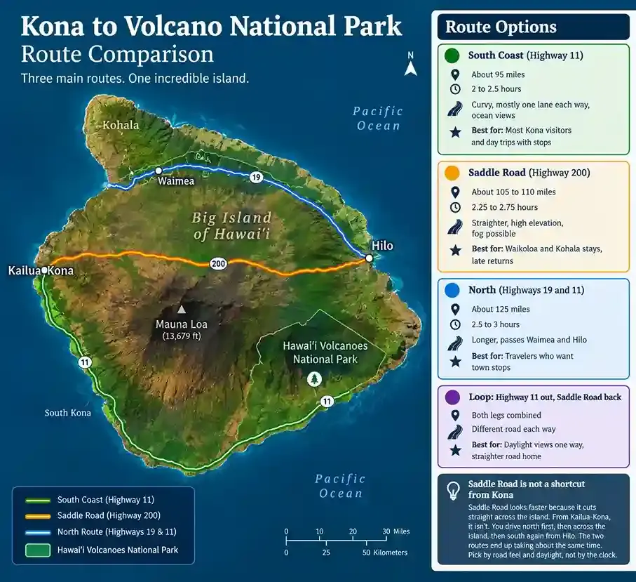
For most first-time visitors, yes. Your biggest constraint is usually the drive, not the park. Hilo is about 45 minutes away, but driving from Kona takes 2 to 2.5 hours each way. If you're coming from the Kona side, a night in Volcano Village saves the long drive back. It also puts you close to the overlooks after dark and the trails at sunrise.

What should you do if Kīlauea is erupting during your visit?
Check the status that morning, watch only from open overlooks and protect yourself from gas and falling glass. An eruption is the most unforgettable thing you can see here. It also changes how the park works that day.
Since late 2024, Kīlauea has erupted in episodes. Lava fountains inside Halemaʻumaʻu for hours, then the volcano pauses for days or weeks. During Episode 50 in June 2026, a fountain shot about 1,000 feet into the air. Our guide Yvonne was there, and you can read what Episode 50 looked like from the rim.
If an episode is on during your trip, follow these five steps:
Check before you drive: Read the daily update from the USGS Hawaiian Volcano Observatory and look at the live webcams. Then check park alerts for closures.
Watch only from open overlooks: The eruption area is closed. Stay behind ropes and signs, and keep back from cliff edges and ground cracks. Never cross a closure for a photo.
Watch the air: Volcanic gas can affect people with asthma, heart or lung conditions, young children, older adults and pregnant women. Check the Hawaiʻi vog dashboard before you go. Regular face masks don't block sulfur dioxide. If you start coughing or feel tight in the chest, leave the area. In the car, close the windows and recirculate the air.
Cover up against falling glass: Fountains can drop tephra and Pele's hair, fine strands of volcanic glass. Wear eye protection, long sleeves, long pants and closed shoes. A dust mask helps with ash. Don't touch or collect any of it. Our volcanic glass field guide explains what you're seeing.
Plan for crowds: Eruptions bring heavy traffic, and lots fill fast. Arrive early and have a backup overlook in mind.
Our volcano hiking safety guide explains vog and volcanic gas in more detail. No one can promise you'll see lava, and we never do. The park is worth the trip either way.
Protect your rental car from tephra
Tephra can coat cars near the summit after an episode. Most damage happens when people try to clean it off.
Skip the wipers: Rinse the windshield with water first. Dry glass grit scratches it.
Wash it gently: Use a touchless car wash, not one with brushes.
Check your rental policy: You're usually responsible for chips and scratches, so confirm your coverage before you go.

What should you avoid doing in the park?
Don't take anything, don't feed anything and don't cross anything that's closed. This land is sacred to Native Hawaiians and fragile underfoot. Most park rules protect both you and the place.
Taking lava rocks, sand or Pele's hair: Removing anything from a national park is illegal. Many Hawaiians see the rocks as part of Pele, so taking them is also disrespectful.
Stacking rocks: Rangers use ahu (rock cairns) to mark trails. New stacks confuse hikers and can be culturally offensive.
Touching petroglyphs: Oils and rubbings wear the carvings away. Look, photograph and keep your hands off.
Feeding nēnē: Fed birds learn to approach cars, and cars kill more adult nēnē in the park than anything else.
Flying a drone: Drones are banned in the park without written permission.
Leaving the trail: Earth cracks can hide under plants, and crater edges can collapse without warning.
Climbing cinder cones: Puʻupuaʻi and other cones erode quickly under footsteps.
Skipping the boot brush: Clean your boots at decontamination stations to stop the spread of Rapid ʻŌhiʻa Death.
Bringing pets on trails: Leashed pets can go on roads, parking areas and in Nāmakanipaio campground, but never on trails.
Parking on the shoulder: Park only in marked spaces. Cars that block lanes get towed, especially on eruption nights.
We treat this as a place to care for, not just visit. Read how we practice Leave No Trace on every hike.
What is there to do near Hawaiʻi Volcanoes National Park?
Just outside the park, you'll find a rainforest village, black sand beaches, coffee farms and Hilo's lava caves. Most are within an hour of the entrance, so they're easy to add before or after your park day.
Place | How far | Why go | Good to know |
Volcano Village | About 5 minutes from the entrance | A rainforest village with cafés, restaurants, art galleries and rentals | The closest place for fuel and groceries |
Volcano Farmers Market | Cooper Center, Volcano Village | Local fruit, baked goods, crafts and a lunch to take into the park | Sundays from 6 to 10 am, so arrive before 9. A smaller market runs Thursday afternoons |
Volcano Winery | Volcano Village | Tastings of wines made with tropical fruit and island-grown tea | Check tasting hours before you go |
Punaluʻu Black Sand Beach | About 30 miles southwest | Black sand, coconut palms and honu (green sea turtles) resting on shore | Stay at least 10 feet from turtles, and don't take any sand |
Kaʻū Coffee Mill | About 30 minutes, near Pāhala | Tastings of coffee grown on the slopes of Kaʻū | Check tour days before you go |
Hilo Coffee Mill | About 20 minutes toward Hilo | Farm tours, a café and a gift shop | An easy stop on the way to or from Hilo |
Pohoiki (Isaac Hale Beach Park) | About an hour | A black sand beach formed by the 2018 lava flow | The surf is often rough |
Kalapana | About an hour | A town partly buried by lava, with a young black sand beach | Wear sturdy shoes on the lava |
Kaumana Caves | About 50 minutes, in Hilo | An unlit lava tube from Mauna Loa's 1881 flow | Bring a headlamp and closed shoes |
Hilo | About 45 minutes | Rainbow Falls, a big farmers market and bayfront gardens | Good base if you're staying a few nights |
Heading back to Kona? Punaluʻu, South Point, Papakōlea Green Sand Beach and Puʻuhonua o Hōnaunau are all on the southern route.
Plan your visit: fees, hours, getting there and where to stay
The park is open 24 hours a day, every day of the year. Here are the basics in one place.
Entry fees: $30 per car, $25 per motorcycle or $15 per person on foot or bike. The pass covers seven days, and the park is cashless. Visiting Haleakalā or Puʻuhonua o Hōnaunau too? US residents can buy the Hawaiʻi Tri-Park Annual Pass. See park entry and meeting points for passes and guided tour fees.
Getting there: The entrance is on Highway 11, about 30 miles and 45 minutes from Hilo. You'll need a car. Hele-On buses stop at the park, but there's no shuttle inside.
Fuel and food: There's no gas or grocery store in the park. Fill up and stock up in Volcano Village or Hilo. Volcano House has the only restaurant on the rim. Packing a picnic? Our trail food guide has easy ideas.
Signal: Cell service is patchy. Download offline maps and the NPS App before you arrive.
Where to stay: Volcano House is the only hotel in the park. Nāmakanipaio and Kulanaokuaiki are the two campgrounds, so check whether they're open before you go. Kīlauea Military Camp rents cabins to eligible military and government guests. Most visitors stay in Volcano Village, 5 minutes away, or in Hilo.
Weather: The summit runs 12 to 15°F cooler than the coast, and rain can come any time of year. Read our guide to the best time to visit for seasons, crowds and lava timing.
What to bring: Layers, a rain jacket, sturdy shoes, sun protection, a headlamp and at least 2 quarts of water each. Our full list of what to bring on a volcano hike covers the rest.
How do you check what's open before you go?
Most of the park stays open, even when a trail or road closes. Closures here are usually short and local. A trail shuts after a run of earthquakes, or a road after a storm, then reopens once it's safe. So check on the morning you drive, not the week before.
Park alerts: Check the park's conditions page for closures, construction and air quality warnings.
Volcano status: The USGS Kīlauea page shows whether the volcano is erupting or paused.
Rangers: Ask at the Welcome Center for the day's trail and air updates.
What if your first pick is closed?
A summit trail is closed: Hike the Kīlauea Iki loop, or walk the Crater Rim Trail to Kūpinaʻi Pali.
An overlook is closed or full: Try Uēkahuna or Kīlauea Overlook on Crater Rim Drive West. Their lots usually have more space.
Mauna Loa Road is closed: Hike Mauna Ulu instead. On a clear day it has wide views of Mauna Loa.
The Nāhuku lot is full: Park at Kīlauea Iki Overlook and walk in, or come back before 9 am or after 5 pm.
Frequently asked questions
What should you not miss at Volcano National Park?
Don't miss the caldera overlooks on Crater Rim Drive, the Kīlauea Iki Trail and Nāhuku (Thurston Lava Tube). Add the steam vents and Chain of Craters Road down to the Puʻuloa Petroglyphs. Together they show you a live caldera, an old lava lake, a lava tube and ancient Hawaiian rock art. If Kīlauea is erupting, add the glow at dusk.
Is Hawaiʻi Volcanoes National Park worth visiting if there's no lava?
Yes. Most of what makes this park special has nothing to do with fresh lava. You can cross a 1959 lava lake, step inside a 500-year-old lava tube and stand over steaming vents. You can also see 23,000 petroglyphs and drive from rainforest to sea cliffs in under an hour.
Do you need a reservation to visit Hawaiʻi Volcanoes National Park?
No. You don't need a reservation or timed-entry ticket for a day visit. Just buy an entrance pass at the gate or online before you go. The park is cashless, so bring a card. You do need to book ahead for campsites, backcountry permits and guided hikes, especially in busy months.
Can you see lava at Hawaiʻi Volcanoes National Park right now?
It depends on the day. Since December 2024, Kīlauea has erupted in short episodes, with pauses of days or weeks in between. When an episode is on, you can see lava fountaining inside Halemaʻumaʻu from the rim overlooks, best after dark. Check the USGS Hawaiian Volcano Observatory update the morning you go.
Is it safe to visit during an eruption?
Yes, if you stay in open areas and follow the closures. The eruption itself is inside a closed area. The real risks for visitors are volcanic gas, unstable cliff edges, ground cracks and falling volcanic glass. People with asthma, heart or lung conditions, young children and pregnant women should check air quality first.
Is the Hōlei Sea Arch still there?
No. The 90-foot Hōlei Sea Arch fell into the ocean on September 27, 2026, after about 550 years. The end of Chain of Craters Road is still worth the drive for its black cliffs and crashing surf. Stay behind the barriers, because the cliffs can give way without warning.
Is the Jaggar Museum open?
No. The Jaggar Museum and the old volcano observatory were damaged in the 2018 collapse and taken down in 2024. The bluff where they stood is now Uēkahuna, a top spot for caldera views. For exhibits and ranger talks, head to the Welcome Center at Kīlauea Military Camp.
Can you visit Hawaiʻi Volcanoes National Park without hiking?
Yes. You can see a lot from your car and short paved paths. Drive Crater Rim Drive to Uēkahuna and Kīlauea Overlook, and stop at the steam vents. Then take Chain of Craters Road past pit craters to Kealakomo Overlook. The free NPS App adds a self-guided audio tour along the way.
What is there to do at night?
The park is open 24 hours. During an eruption, the glow over Halemaʻumaʻu is the big draw, best watched from open rim overlooks after sunset. On clear, moonless nights, the stargazing is excellent. You can also walk Nāhuku with your own flashlight. Bring warm layers, because the summit gets cold after dark.
What are the best things to do with kids?
Kids love Nāhuku, the steam vents, the paved Devastation Trail and the Earthquake Trail to Kūpinaʻi Pali. Pick up a free Junior Ranger booklet at the Welcome Center. Skip the Sulphur Banks with infants or young children, because of the gas. Our Keiki to Kūpuna family walk adds a scavenger hunt on the crater rim.
Do you need a guide to visit the park?
No. Trails are marked, and you can explore the park on your own. A guide adds the stories, geology and Hawaiian culture behind what you're seeing. Your guide also knows which routes are open and safe that day. Read why hike with a guide to see what a guided hike adds.
Can you take lava rocks home?
No. Taking rocks, sand or anything else from a national park is illegal. Many Hawaiians also see the lava as part of Pele, so taking it is disrespectful. Leave every rock, crystal and strand of Pele's hair where you find it, and take photos instead.
Have a question about our hikes? Our tour FAQ covers meeting points, what's included and how to book.
Plan your day around the volcano
Remember the big five? The caldera, Kīlauea Iki, Nāhuku, the steam vents and Chain of Craters Road are the heart of any visit. But this park never stands still. Trails close, lava returns without much warning and old landmarks fall into the sea. The visitors who get the most out of it plan around today's conditions, not last year's photos.
Here's your plan, in order:
Check the status: Look at park alerts and the USGS update the morning you go.
Pick your three: Choose three things from our top five, then add one quieter corner if you have time.
Go early: Start before 9 am for open lots, clear crater views and cooler trails.
Want a guide on the trail? Book a guided volcano hike with our small team, or send us a message and we'll help you plan. You can also read more about who we are and how we care for this land.
Which of these 20 is first on your list?
About the author
Jennifer Bell is the founder and lead guide of Volcanoes Hiking Guides. She holds a BA in Recreation Management from the University of Montana. Before Hawaiʻi, she worked as a guide in Yellowstone and in environmental education. Jennifer is a certified Wilderness First Responder. She is also listed as an owner and guide on the company's Commercial Use Authorization. Together, our guides bring more than 20 years of combined professional guiding experience.


Comments